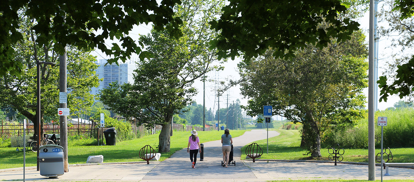
Trail Concept

Trail Concept

THE MEADOWAY MULTI-USE TRAIL

woman with stroller and friend explore hydro corridor trail network

THE OPPORTUNITY

A complete active transportation system linking eastern Toronto to the downtown core is missing from the existing trail network.

Opportunities to expand and construct new trail networks in urban environments are typically limited. Hydro corridors, however, have the potential to be re-purposed as accessible, ecologically diverse green spaces that permit active trail use.

The Meadoway will revitalize and restore the existing corridor and establish a full connection between downtown Toronto and the Rouge National Urban Park via an accessible multi-use trail network.

The Meadoway study area map

STUDY AREA

The Meadoway Class EA is divided into two distinct areas of study to assess potential project effects:

Local Study Area – The zone where direct effects of the project may occur

Regional Study Area – A larger zone where direct and indirect effects of the project may occur, taking into account the cumulative effects to which the project may contribute.

Through previous projects a total of 10 kilometres of multi-use trail have been constructed, along with bicycle crossing signalization at major intersections. The objective is to extend the existing trail network the full 16-kilometre length of The Meadoway project area.

joggers and pedestrians on hydro corridor trail network in Scarborough

THE PROCESS

The planning and design of the remaining six (6) kilometres of the multi-use trail and potential bridge crossings follows the Municipal Class Environmental Assessment¹ (Class EA ), Schedule C process.

The Class EA process considers all environmental factors², ensuring that the project avoids (or minimizes) adverse effects before it is built.

Consultation with the public, property owners, Indigenous communities, affected agencies, government agencies and other interest groups is a pivotal part of the process.

For more information about the Environmental Assessment Process, please refer to our FAQs.


¹An Environmental Assessment is a process, or an assessment, used to predict the environmental impacts and effects (both positive and negative) of a project prior to implementation.
²Including the biological, physical, social and economic environments.

PLANNING PHASES

The Meadoway Class EA will identify and evaluate a range of potential multi-use trail alignments that will culminate in a preferred main trail route.

The project is currently in phase four of a five-phase process:


PHASE 1: EXISTING CONDITIONS AND OPPORTUNITY STATEMENT

• Identified the problem and the opportunity; this is communicated in an opportunity statement.
• Prepared a detailed inventory of existing conditions within the Local and Regional Study Areas.
View the Opportunity Statement.

2

PHASE 2: IDENTIFY AND EVALUATE ALTERNATIVE TRAIL ALIGNMENTS

• Identified and evaluated a series of alternative routes for the multi-use trail, called alternative trail alignments.
• Selected a preferred alternative trail alignment.
• View the alternative trail alignments.
• View the evaluation criteria.
• View the preferred trail alignments: SECTION 3 | SECTION 5 | SECTION 6.
• View the full preferred trail alignment.

3

PHASE 3: IDENTIFY AND EVALUATE DESIGN CONCEPTS FOR PREFERRED ALIGNMENTS

• Identify and evaluate a series of alternative design concepts for the preferred trail alignments.
• Select a preferred design concept.
View the alternative design concepts.
View the evaluation criteria.
• View the proposed preferred design concepts: SECTION 5 (Highland Creek Alignment) | SECTION 6 (Chartway Blvd. Alignment) | SECTION 6 (Ellesmere Ravine Pedestrian Water Crossing)
View the full proposed preferred design concepts.

4

PHASE 4: ENVIRONMENTAL STUDY REPORT (ESR)

• Completed the Environmental Study Report (ESR), which documents the full decision-making process.
• Allow for a 45-day public review period for the ESR.

5

PHASE 5: DESIGN AND IMPLEMENTATION

• Complete contract drawings and tender documents.
• Proceed to construction.
• Monitor construction for adherence to environmental provisions and commitments.

ENVIRONMENTAL STUDY REPORT

A Municipal Class Schedule C Environmental Assessment (Class EA) was undertaken for The Meadoway, the objective of which was to establish a complete active transportation route within the Gatineau hydro corridor in Scarborough.

As part of the Class EA process, an Environmental Study Report (ESR) was prepared, which highlights the planning, consultation, and decision-making process.

Following a 45-day public review period, the ESR has now been filed and the project has been approved to move into the detailed design and implementation phase.

Download the ESR and Appendices

Environmental Study Report

ESR Appendices

CONSULTATION

Public consultation is one of the main components in a Class EA process. It provides an opportunity for the public to engage and provide their insight on the project.

Public consultation for The Meadoway Class EA was held in the form of Public Information Centres (PICs).

TRCA has completed all three PICs for The Meadoway Class EA.

CONSULTATION EVENTS

Public Information Centre #1 — April 24, 2019

The first PIC was held to introduce and seek feedback on The Meadoway Class EA and preliminary visualization toolkit.

community members examine Meadoway map at public information centre

The focus of the meeting was on the following:

  • Opportunity statement
  • Existing conditions
  • Preliminary alternative trail alignments
  • Proposed evaluation criteria
  • Preliminary visualization toolkit

View Materials from the First PIC

Public Information Centre #2 — June 26, 2019

The second PIC was held to provide an update and seek feedback on Phase 2 of The Meadoway Class EA, and on the visualization toolkit.

TRCA team member speaks to community members at Meadoway public information centre

The focus of the meeting was on:

  • Alternative trail alignments
  • Preliminary evaluation of the alternative trail alignments
  • Proposed preferred trail alignments

View Materials from the Second PIC

Public Information Centre #3 — October 23, 2019

The third and final PIC was held to provide an update and seek feedback on Phase 3 of The Meadoway Class EA, and to share with the public the completed visualization toolkit.

TRCA team member speaks to resident at Meadoway Public Information Centre

This PIC focused on:

    • Evaluation of design concepts for the preferred trail alignments
    • Proposed preferred design concepts
    • Mitigation measures

View Materials from the Third PIC