
Full Steam Ahead on The Meadoway Multi-use Trail
Posted June 11, 2020
Spring has certainly sprung in The Meadoway!
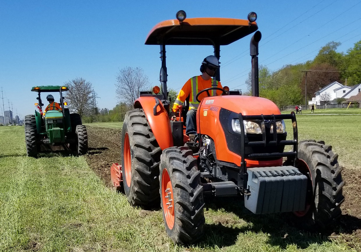
As the days become warmer and meadow habitat begins to green, our restoration teams are busy with their continued efforts to transform the 16 km hydro corridor into a vibrant, naturalized, and immersive greenspace.
Another exciting milestone in support of developing the full potential of The Meadoway is just around the corner.
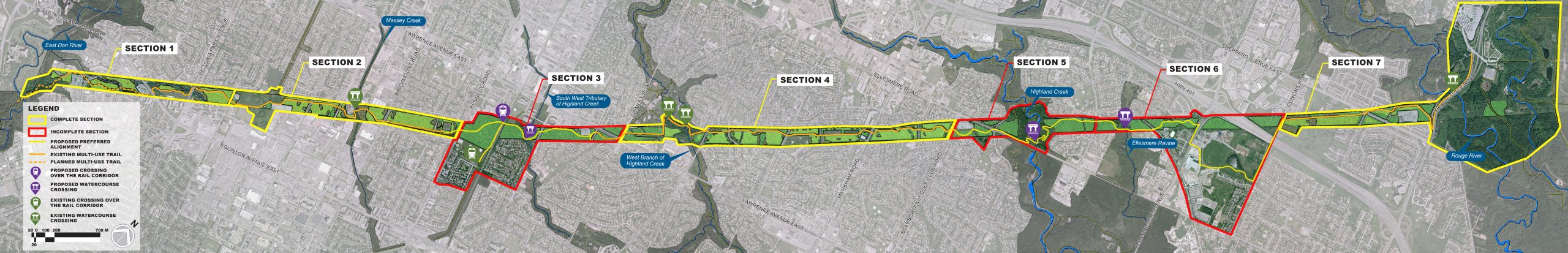
With the Environmental Assessment now complete and the gaps in the existing trail network identified, the coming months will see significant progress towards completing the “backbone” of The Meadoway: the 16 km multi-use trail network that will wind its way from the Don Valley all the way to Rouge National Urban Park.
Converting what has been, up to this point, a simple conceptual plan-on-paper into a physical reality is no easy feat — and building a multi-use trail within a setting as complex as a hydro corridor requires careful planning and preparation.
The first gap to be developed is Section 5 Highland Creek, an area of The Meadoway bounded to the west by Scarborough Golf Club Road and to the east by Neilson Road.
This stretch of The Meadoway traverses a small segment of the Highland Creek Ravine system, with its sinuous river, numerous marsh and coniferous swamp wetlands, and steep vegetated valleys.

In order to develop The Meadoway in harmony with the ravine habitat that it crosses, our teams have been busy this spring undertaking and planning for the field work that will guide the safe design and construction of the trail system.
Biological inventories of all flora and fauna species have been completed, and our team of arborists are preparing tree protection and restoration plans throughout the full stretch of the proposed trail alignment.
Ensuring minimal disruption to sensitive habitat and wildlife is key, and Toronto and Region Conservation Authority (TRCA) ecologists are preparing for field surveys that will include full evaluations of nearby wetlands and monitoring plans for vulnerable bat habitat.
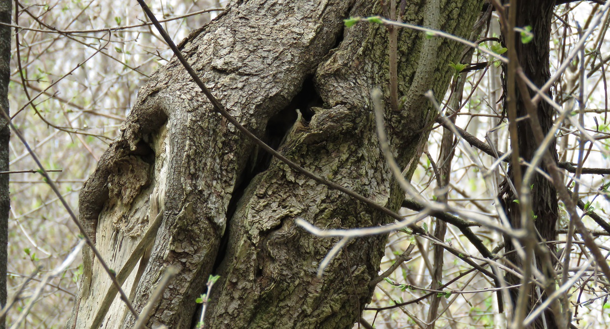
Bat habitat
Understanding and protecting this region’s cultural heritage is also of critical importance.
TRCA archaeologists are now busy preparing for a full (stage 2) archaeological assessment of the future trail this summer, to explore the potential of pre-Contact and Euro-Canadian resources.
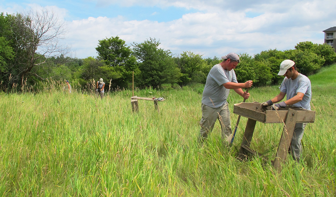
Members of TRCA’s archaeology team in the field.
A host of technical investigations are also underway, including geotechnical studies to ensure the safe construction of the pedestrian bridge over Highland Creek
Permits and approvals, meanwhile, are being prepared to ensure compliance with regulatory requirements and to make certain that mitigation measures are being followed.
In short, there is a lot going on behind the scenes as our team works full steam ahead on developing the multi-use trail network.
Stay tuned for more news as we move forward into the summer and fall of 2020. And don’t forget to visit our What’s Happening Now page for regular progress reports on restoration and trail design efforts.

Posted by Corey Wells
Corey Wells is a Project Manager with the Project Management Office at Toronto and Region Conservation Authority (TRCA).
Corey graduated from the University of Waterloo with a Master of Science in Hydrology, and has spent the last 10 years working in the field of environmental research, management, and design on a variety of scales: in Alberta’s oil sands region, in northern Canada’s James Bay lowlands, and, most recently, in Toronto’s urban context.
As Project Manager, Corey leads the overall planning and design of The Meadoway’s active transportation network.